Authored by the expert who managed and guided the team behind the Philippines Property Pack

Everything you need to know before buying real estate is included in our The Philippines Property Pack
Manila faces significant flooding challenges that property buyers need to understand before making investment decisions.
Flood risks in Manila vary dramatically by neighborhood, with some areas like CAMANAVA and parts of Taft Avenue experiencing waist-deep flooding almost every rainy season. Understanding these patterns is crucial for making informed real estate decisions in the capital.
If you want to go deeper, you can check our pack of documents related to the real estate market in the Philippines, based on reliable facts and data, not opinions or rumors.
Manila experiences annual flooding with certain neighborhoods like CAMANAVA, Marikina, and sections of Taft Avenue seeing 1-2 meter deep floods that can last up to three days.
The flood season runs from July to October, with August being the wettest month averaging 475mm of rainfall and 14-19 heavy rain days.
| Aspect | Details | Impact on Property Investment |
|---|---|---|
| High-Risk Areas | CAMANAVA, Marikina, Pasig, Taft Avenue, España Boulevard | Property values 15-30% lower, limited buyer interest |
| Flood Depth | 1-2 meters (waist to chest deep) | Ground floor properties unsuitable for living/business |
| Duration | 3 hours to 3+ days depending on location | Extended business interruption, higher maintenance costs |
| Frequency | Annual in high-risk areas, severe floods every 1-2 years | Recurring repair costs, insurance complications |
| Peak Season | July-October (typhoon season) | Seasonal rental market impact |
| Insurance Cost | ₱3,000-₱15,000 annually for modest homes | Additional operational expense for investors |
| Utility Disruption | 1-3 days for power, water, internet | Reduced tenant satisfaction, vacancy risks |

Where in Manila do floods happen most often and how severe are they in those exact neighborhoods?
The CAMANAVA area (Caloocan, Malabon, Navotas, Valenzuela) experiences the most frequent and severe flooding in Manila.
Taft Avenue and España Boulevard, particularly near UST and FEU, also face regular flooding that transforms streets into river-like conditions during heavy storms. Marikina and Pasig are additional high-risk areas where flooding occurs almost every rainy season.
In these neighborhoods, floodwater typically reaches 1-2 meters deep (waist to chest level for most people). Navotas, Malabon, and parts of Marikina experience the most persistent flooding, where water can remain for over three days after heavy rainfall. These areas are particularly vulnerable because many districts sit below sea level and have inadequate drainage systems.
Property investors should be aware that real estate values in these flood-prone neighborhoods are typically 15-30% lower than comparable properties in safer areas. Ground-floor commercial spaces and residential units often become unusable during flood seasons, significantly impacting rental income potential.
It's something we develop in our Philippines property pack.
How often has serious flooding actually happened in Manila in the past 5 to 10 years?
Serious flooding has occurred almost every rainy season in Manila's high-risk areas over the past decade.
While catastrophic events like Typhoon Ondoy in 2009 represent extreme cases, damaging floods have become an annual occurrence in vulnerable neighborhoods. The most affected districts experience major flooding disruption approximately once every 1-2 years, with a 5-year return period for severe flooding events.
Between 2015 and 2025, Manila has recorded significant flooding events during each rainy season, with particularly severe incidents during enhanced monsoon periods and typhoon seasons. Even when major typhoons don't make direct landfall, their indirect effects combined with the southwest monsoon contribute to over a third of wet season rainfall.
This frequency has important implications for property investment, as recurring flood damage leads to higher maintenance costs, insurance complications, and reduced property appreciation rates in affected areas.
What is the average rainfall during typhoon season in Manila and how many days of heavy rain does the city usually get?
Manila's wettest months from June through September receive substantial rainfall that directly contributes to flooding risks.
| Month | Average Rainfall | Heavy Rain Days |
|---|---|---|
| June | 255 mm | 14-16 days |
| July | 430 mm | 16-18 days |
| August | 475 mm | 17-19 days |
| September | 395 mm | 15-17 days |
| October | 180 mm | 10-12 days |
August represents the peak of the rainy season with 475mm of average precipitation and up to 19 days of heavy rainfall. This concentration of rainfall, combined with typhoon activity and the southwest monsoon (Habagat), creates the conditions for Manila's most severe flooding events.
Which months of the year are the riskiest for flooding in Manila?
July through October represent the highest flood risk period in Manila.
This timeframe coincides with both the southwest monsoon (Habagat) season and peak typhoon activity in the Philippines. August stands out as the most dangerous month, with maximum rainfall intensity and the highest probability of flooding events across all risk areas.
September and October maintain elevated risk levels as typhoon season continues, though rainfall typically begins to decrease. Property managers and investors should expect potential disruptions, utility outages, and access problems during this four-month window.
For property investment purposes, this predictable seasonal pattern means rental markets may experience temporary declines during flood season, particularly for ground-floor units in high-risk areas.
Don't lose money on your property in the Philippines
100% of people who have lost money there have spent less than 1 hour researching the market. We have reviewed everything there is to know. Grab our guide now.

How deep does flood water typically get in affected areas of Manila, and how long does it usually take to subside?
Floodwater in Manila's high-risk areas commonly reaches 1-2 meters in depth, making most ground-floor spaces uninhabitable during flood events.
In the most vulnerable neighborhoods like CAMANAVA, Marikina, and Pasig, water levels can exceed head height for average adults. The duration varies significantly by location and drainage capacity - minor floods may recede within several hours, while severe flooding in lower-lying areas can persist for over three days.
Areas like Navotas and Malabon consistently experience the longest drainage times due to their below-sea-level elevation and limited pumping capacity. During major events, residents may be trapped in upper floors for several days until water levels drop sufficiently for safe movement.
These extended flood durations create serious implications for property investors, as they result in prolonged business interruptions, increased structural damage from water exposure, and higher restoration costs.
What official flood hazard maps or government resources can I check to see the exact risk for my address in Manila?
Several government platforms provide address-specific flood risk assessments for Manila properties.
PAGASA's Flood/Climate Hazard Maps offer detailed risk overlays for specific locations throughout Metro Manila. The NOAH (National Operational Assessment of Hazards) Web Portal provides real-time risk data and historical flooding information that can be searched by address.
HazardHunterPH delivers the most precise address-level flood risk assessments and is commonly used for insurance evaluations. This platform allows property buyers to input exact addresses and receive detailed risk profiles including historical flood data, projected risks, and insurance recommendations.
These tools are essential for property due diligence, as they provide official government data that insurance companies and lenders often require for flood-prone areas.
It's something we develop in our Philippines property pack.
How effective are the current flood control projects and drainage systems in Manila right now?
Current flood control infrastructure in Manila has reduced flooding frequency but has not eliminated the problem in high-risk areas.
Major projects like the CAMANAVA flood control system and pumping stations throughout Manila have improved conditions compared to previous decades. However, outdated drainage systems, waste management issues, and the fact that many districts sit below sea level continue to create vulnerabilities during extreme weather events.
Stormwater drainage improvements help manage normal rainfall, but prove insufficient during enhanced monsoon periods or typhoon-influenced weather. The combination of aging infrastructure, rapid urbanization, and climate change effects means that even improved systems can be overwhelmed.
Property investors should understand that while flood control measures provide some protection, they don't guarantee immunity from flooding, particularly in historically vulnerable neighborhoods.
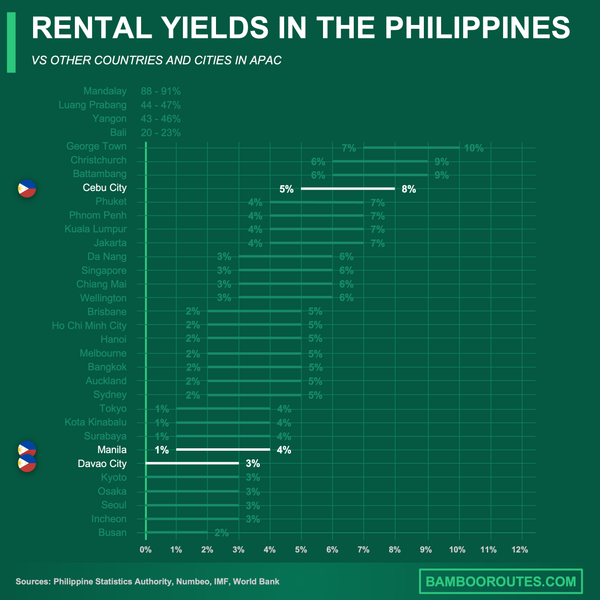
We did some research and made this infographic to help you quickly compare rental yields of the major cities in the Philippines versus those in neighboring countries. It provides a clear view of how this country positions itself as a real estate investment destination, which might interest you if you're planning to invest there.
What are the emergency evacuation routes and shelters available in Manila in case of severe flooding?
Metro Manila maintains over 1,300 official evacuation centers, though many are located in areas that may also experience flooding.
Local government units post updated evacuation routes and designated shelters before each rainy season, typically through barangay offices and official social media channels. However, shelter capacity becomes limited in high-density areas like San Juan and Navotas during major flood events.
Evacuation routes typically direct residents from low-lying areas toward higher ground and multi-story public buildings like schools, gymnasiums, and community centers. The challenge is that many designated shelters are themselves vulnerable to flooding, requiring secondary evacuations during severe events.
Property owners in flood-prone areas should familiarize themselves with local evacuation procedures and consider this infrastructure limitation when evaluating long-term investment viability in high-risk neighborhoods.
How do floods in Manila impact utilities like power, water supply, and internet connectivity, and for how long are they usually disrupted?
Flooding in Manila typically disrupts essential utilities for 1-3 days, with restoration time depending on flood depth and infrastructure damage.
Power outages are common as substations and electrical lines become inundated. Water supply can be contaminated or interrupted due to treatment facility flooding or pipeline damage. Internet and telecommunications face similar vulnerabilities when ground-level equipment is submerged.
In severely affected areas like CAMANAVA and Marikina, utility restoration may take longer due to access difficulties and the need for safety inspections before reconnection. Some areas may experience rolling blackouts even after initial restoration as demand exceeds damaged system capacity.
These utility disruptions significantly impact rental properties, as tenants may temporarily relocate during extended outages, leading to vacancy periods and reduced rental income for property investors.
What practical steps do residents in Manila take to protect their homes and belongings against flooding?
Experienced Manila residents implement several flood protection measures based on local knowledge and repeated exposure to flooding events.
1. **Electrical modifications**: Elevating outlets, switches, and electrical panels above typical flood levels2. **Physical barriers**: Installing sandbags, water barriers, and flood gates around property perimeters3. **Drainage improvements**: Adding one-way drain valves and motorized pumps to prevent backflow4. **Storage solutions**: Creating elevated storage areas and waterproofing important documents5. **Early preparation**: Moving vehicles to higher ground and evacuating valuable items when flood warnings are issued6. **Insurance coverage**: Purchasing comprehensive flood insurance policiesMany residents also maintain emergency supplies including portable generators, water purification tablets, and communication devices. Property investors should factor these additional protection costs into their investment calculations.
How much can flood insurance cost in Manila and what exactly does it cover?
Flood insurance in Manila typically costs ₱3,000-₱15,000 annually for modest residential properties, depending on location, property value, and risk assessment.
Basic policies usually cover structural repairs for water damage to buildings and contents, including furniture, appliances, and personal belongings. However, coverage varies significantly between providers, and many policies exclude certain types of damage or have limitations on temporary relocation expenses.
Business interruption coverage, which compensates for lost rental income during flood recovery periods, often requires separate riders and additional premiums. Some policies also exclude damage from "acts of God" or may have lengthy waiting periods before coverage becomes effective.
Property investors should carefully review policy terms, as flood insurance can represent a significant ongoing expense that affects overall investment returns, particularly in high-risk areas where premiums are highest.
It's something we develop in our Philippines property pack.
What apps, hotlines, or alert systems should I rely on in Manila to get real-time flood warnings and updates?
Several reliable platforms provide real-time flood monitoring and warning systems for Manila residents and property managers.
The PAGASA Mobile App and website deliver official rainfall forecasts, flood advisories, and typhoon tracking information directly from the national weather service. NOAH and HazardHunterPH platforms offer real-time flood mapping and location-specific alerts.
NDRRMC (National Disaster Risk Reduction and Management Council) operates emergency hotlines that provide immediate assistance and evacuation information during flood events. Local government units also maintain SMS broadcast systems and official social media groups on Facebook and Viber for community-specific updates.
Property investors should subscribe to multiple alert systems to ensure they receive timely warnings that allow for protective measures and communication with tenants or property managers during flood events.
Conclusion
This article is for informational purposes only and should not be considered financial advice. Readers are advised to consult with a qualified professional before making any investment decisions. We do not assume any liability for actions taken based on the information provided.
Manila's flood risks are a reality that property investors cannot ignore, with certain neighborhoods experiencing annual flooding that significantly impacts property values and rental income.
While flood control measures provide some protection, the combination of geographic vulnerability, aging infrastructure, and climate change effects means flood risks will likely persist in high-risk areas for the foreseeable future.
Sources
- Reliable Insurance PH - Disaster Prone Areas in Metro Manila
- Earth Journalism Network - Flood Risk Areas in Metro Manila
- Wiley Online Library - River Research and Applications
- Climate to Travel - Manila Climate Data
- PreventionWeb - Tropical Cyclone Effects During Monsoon
- PAGASA - Tropical Cyclone Information
- Climate Change Commission Philippines
- FloodList - Philippines Flood Reports